
We seem to be out of step with the rest of the boating world
here. The guidebooks that we read implied that we would be
fighting for space in the limited number of good anchorages, but nothing could
be further from the truth. We are usually alone in whatever bombproof/scenic cove
we settle on for the night. Occasionally one other boat will be in the same
area, but rarely close. We have been seeing one small powerboat, Pacific Wanderer, off and on since Port
Alice; we exchange hellos and they go anchor somewhere else for privacy and
close enough to shore to walk their cute little puppy. The largest number of
boats we had encountered was our first night in Columbia Cove, when we shared
the cove with five other boats. They all left the next day and we never saw any
of them again. Our trip down the coast is quite late in the season so we aren’t
finding a lot of other boats out there. One of the reasons so many boats do the
trip earlier, in June and July, is that the fog is much less prevalent then,
but it comes on strong in August. We are finding that “Fogust” is alive and
well. We are also finding that we are, by necessity, much more comfortable
traveling in fog. Anne’s claustrophobia comes out in fog so she is a little
uneasy, but she soldiers on. We can usually see far enough ahead that we can
avoid debris in the water, and our electronic aids keep us on track and off the
rocks. One huge positive of traveling at this time is that the weather is
beautiful, once the fog burns off.

The exception to our solitude was our last night in the
Bunsby Islands. We were alone in Scow Bay, in fact we were alone in the
Bunsbies. We had done our dinghy exploration and there were no other boats here,
not that it would have mattered; in most anchorages the boats try and leave
personal room for each other. However, that afternoon one sailboat came in to
Scow Bay and anchored within 100 feet of us. What? There are four glorious
anchorages, each with room for two to ten boats and someone is so needy they
anchor three boatlengths away? I guess anchorage etiquette isn’t taught some
places.
 |
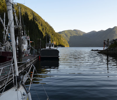
| Walters Cove, Kyuquot |
We were impressed by Kyuquot, on the way in a small local
boat changed course and came over to wish us welcome, and while walking around
several people asked us if we liked Kyuquot. We could answer honestly that we
were impressed. The people were friendly and the community was interesting, if
not rich. The collapse of the fishing industry was hard on Kyuquot, they no
longer have fleets of fishboats crowding the docks, so they are making do. The
general store is only open from 1-5 every afternoon, and they control the water
on the dock; $5 gets you a fill, but you may have to wait for the hose. They
used to have a fuel dock with water on it, but that closed so now the only
source of fuel in Kyuquot Inlet is in Fair Harbour, quite a distance away. The
other thing Kyuquot doesn’t have is liquor. It’s a dry community and seems to
be much better for it.

The internet café we posted the last entry from used to
be the school, until that closed and was repurposed as Java the Hutt, boat-through coffee shop and restaurant. They are
open until 6 daily but only cook full meals on Thursdays, which is when the local
supply ship Uchuck III comes in with new stock for the store and occasional
tourists. There is a thriving sportfishing industry there, with lodges and
dozens of identical sportfishing boats, but there doesn’t seem to be much
trickledown to the community.

We left Kyoquot quite late due to the need to access the
internet, so we didn’t arrive at our selected destination until after 8 PM. On
the way, we were amazed at the endless vistas inside Kyoquot Sound, empty of
any other boats or signs of human habitation. Dixie Cove, on Hohoae Island, got
excellent write-ups by the various guide books so we knew it would be calm,
scenic, and had good mud for anchoring. Again, we were surprised to find nobody
else there, but we settled in for dinner as wisps of fog slid by the entrance,
building for the night.

When we left Dixie Cove the next morning, Tuesday August 6, intending
to anchor close to the beaches at Rugged Point so we could do some
beachwalking, the fog outside was thinning out, but by the time we got halfway
to the entrance we could see that it was a solid grey fog bank out there on the
outside. There is zero radio reception in Dixie Cove so we couldn’t hear the
weather forecasts on VHF, so we wanted to get out to clear water to hear a
forecast and have a look for ourselves.
We managed to pick enough information
from the garble and static to reassure us that we weren’t in for anything
nasty, then made our way to Blue Lips Cove in Amai Inlet as our next chosen
spot. More picturesque than Dixie Cove, we liked Blue Lips Cove a lot, except
for the same problem with radio reception.
When your only weather information
comes over the VHF, it’s tough being without. We had been there for a few
hours, soaking up the sunshine and doing explorations in the kayak and dinghy,
when our friends on Pacific Wanderer
showed up. They waved, we exchanged pleasantries, then they chugged off and anchored
as far away as they could. That’s how it’s supposed to work.
When we awoke on Wednesday, there were a few strands of fog
outside the entrance, but the sky was clear and we had high hopes so we raised
anchor by 7 AM and slid quietly out of the cove. We had breakfast and did our
morning ablutions under way, which we frequently do when we’re on passage. Shaving
in a lumpy sea can get very entertaining, but this was smooth water. When we
got closer to the entrance to the Sound, we could tell it was solid fog again.

Well, we needed to get moving, and I thought that we might get out of the fog
shortly since it seemed to thin a bit to the south, so we drove into it. It was
unfortunate that we didn’t get to see the magnificent beaches at Rugged Point,
or anything else for the first ten miles, but as we got closer to Esperanza
Inlet the fog thinned and eventually disappeared and left us floating on a
calm, sunny ocean. “Calm” if you don’t count the constant 3-foot swell that is
everywhere in open water on the west coast. That swell makes light-air sailing
almost impossible out there, we can’t keep the sails full when the boat is
moving up and down and sideways three feet every seven seconds.
We went around all the many rocks and reefs and followed the
buoys marking the clear channel in to Esperanza, and anchored in solitary
splendor in Queen Cove, which the guidebooks told us was a hugely popular
anchorage. It was, in our terms. One small fishing boat came in at dinner time
and anchored for the night, far away from us. It was quite windy in the
afternoon, but as the day drew on, the wind went away, the fog came back and we
were once again surrounded by grey mist, but with a nice patch of blue sky
above us and sunshine warming us. Eventually the fog overtook everything and
when the rigging started to drip on us we moved inside.
 |
| Approaching Zeballos |
The next morning, Thursday, the fog was heavy but started to
break up as the sun warmed the air. We slid quietly out of Queen Cove and set
out for the upper reaches of Esperanza, at first in no wind, then in a rapidly
building inflow wind of over 20 knots. As the wind rose, the fog dissipated
completely and we had a big push from the wind and tide all the way to
Zeballos. The ride up was very scenic, and the terrain is quite different from
what we see coming down the coast. Apparently much of this area is the result
of volcanic activity. Coming around the last corner of the inlet and seeing
Zeballos nestled on the flank of a mountain was quite impressive.
Zeballos, like a lot of west coast towns, got hit hard by
the downturn in the fishing and mining industries. Once having a population of
over 3000 at the height of the gold boom, it is down to about 125 permanent
residents. One of the positive effects of this is that real estate is extremely
affordable and Zeballos is seeing more retirees buying in.
 |
| Zeballos fixer-upper, comes with fishing boat in front yard |
There is still a
very good sport fishery around here, which attracts people from all over, and
the local motel is full of fishermen and loggers, which keeps the local economy
moving to some extent. Unlike many of the places we have been lately, Zeballos
has road access, so they have a little more selection at the few stores, but
still nothing like we’re used to in The Big City. Port McNeill was the last real “supermarket”
we were in, and oddly enough The cook at the local café at the motel here was
raving about the meat she gets from the butcher at the SuperValu in Port
McNeill, with which we heartily agreed. We haven’t had meat that good and that
reasonably priced for a long time, including back in Victoria. It’s odd how
things link up sometimes.
 |
| Zeballos Small Craft Harbour |
We are looking forward to a real store at our next stop,
Tahsis. They get their deliveries on Friday morning, so we are going to
actually have some choice. We have missed the fresh food deliveries all the way
down the island so far, so pickings have been a little slim. Tahsis is going to
be the last major stop before Tofino, so we are going to have to stock up. That
will make two nights in a row at a dock, which is very unusual. We couldn’t get
internet access at Zeballos, or cell phone service for that matter, so we are
feeling technologically deprived.
Well, Tahsis was a bit of a surprise. Westview Marina was
very accommodating, had a slip ready for us, 30 Amp power and all, so we slid
right in. But not before negotiating the breakwater, which is very tricky for
the first time in a sailboat, and once we were there, we noticed a distinct
familiarity to the motion.
 |
| This looks about the same width as our boat the first time through... |
There is something about the head of long inlets,
they are silk smooth in the morning, then as the breeze gets up, the waves
build. Port Alice, Zeballos, and now Tahsis, it’s like garden pond in the
morning and Hurricane Alley in the afternoon. We have learned to park the
dinghy across the stern to stop the waves slapping loudly. We are developing
some survival techniques, since I haven’t yet learned to park facing the waves.
Duh.
So, the surprise part. Tahsis has about at most 2% more
stuff than Zeballos, and less than Kyuquot. We were expecting Bountiful
Harvest. The marina gave us a courtesy car to get to town, so we went to the
Tahsis supermarket and liquor outlet. That was painful, since we have been
deprived since Winter Harbour and were expecting a little more choice and
better prices. The delivery was supposed to be today. Some of the meat in the
freezer dated to the Pleistocene, and were priced for starving gold miners. You
could hammer nails with the bananas. They had many kinds of Canadian whisky,
and few Scotches. It’s a classic fishing town. Some of these 16’ fishing boats
are worth more than our house in Victoria. Seriously.
Today, down inlet to either Bodega Cove, halfway to the
mouth, or all the way to either Friendly Cove, on Nootka Island, or Bligh Cove
on Bligh Island. We’ll see where we really end up. More from our next stop –
Tofino?


 It was only a short run to Bottleneck Cove, so we were
anchored again by just after 2 PM. This gave us a chance to try out the cockpit
canopy we had built, and it worked well to keep us out of the hot sun. We were
alone for a few hours until a 60-plus-foot sportsfishing boat came in and
anchored at the far end of the cove. Thankfully, he had a quiet generator and
turned it off for the night. Some powerboaters feel the need to run their
generators non-stop at anchor, presumably to power their large flat-screen
TV’s. Why spend all that time and money getting somewhere so you can sit around
and watch TV? Beats me.
It was only a short run to Bottleneck Cove, so we were
anchored again by just after 2 PM. This gave us a chance to try out the cockpit
canopy we had built, and it worked well to keep us out of the hot sun. We were
alone for a few hours until a 60-plus-foot sportsfishing boat came in and
anchored at the far end of the cove. Thankfully, he had a quiet generator and
turned it off for the night. Some powerboaters feel the need to run their
generators non-stop at anchor, presumably to power their large flat-screen
TV’s. Why spend all that time and money getting somewhere so you can sit around
and watch TV? Beats me.


 Overnight revealed an even better source of fresh water, as the rainfall
was very heavy. We had put up our other “wind/rain tarp cover” setup to keep at
least some of the cockpit dry, and we were glad of it. We were also running a little thin on drinking water, so the rainfall gave us fresh water for two days, collected in a variety of containers set up to catch the tarp runoff. Our little trickle waterfall of the day before
was now a gushing torrent, and a new waterfall had sprung up on the sheer cliff
face above the cove, hidden and revealed as the fog rolled past. Another boat from Bottlneck Cove had come in and were on the other side of the bay. We envied their full cockpit enclosure.
Overnight revealed an even better source of fresh water, as the rainfall
was very heavy. We had put up our other “wind/rain tarp cover” setup to keep at
least some of the cockpit dry, and we were glad of it. We were also running a little thin on drinking water, so the rainfall gave us fresh water for two days, collected in a variety of containers set up to catch the tarp runoff. Our little trickle waterfall of the day before
was now a gushing torrent, and a new waterfall had sprung up on the sheer cliff
face above the cove, hidden and revealed as the fog rolled past. Another boat from Bottlneck Cove had come in and were on the other side of the bay. We envied their full cockpit enclosure.


