Saturday, 7 September 2013

The Broken Group Part 2

The weather finally turned, and we left Ucluelet on a bright and sunny morning on Saturday, August 31. We actually got to sail for a change, so we were feeling pretty good about life. We were clean, well-fed, stocked up, and dry.

Our destination was Effingham Bay, the only all-weather anchorage in the Outer Islands of the Broken Group. All the other coves were exposed to seas or winds from some direction, so we planned to use Effingham as a base for the mothership while we explored in the dinghy.
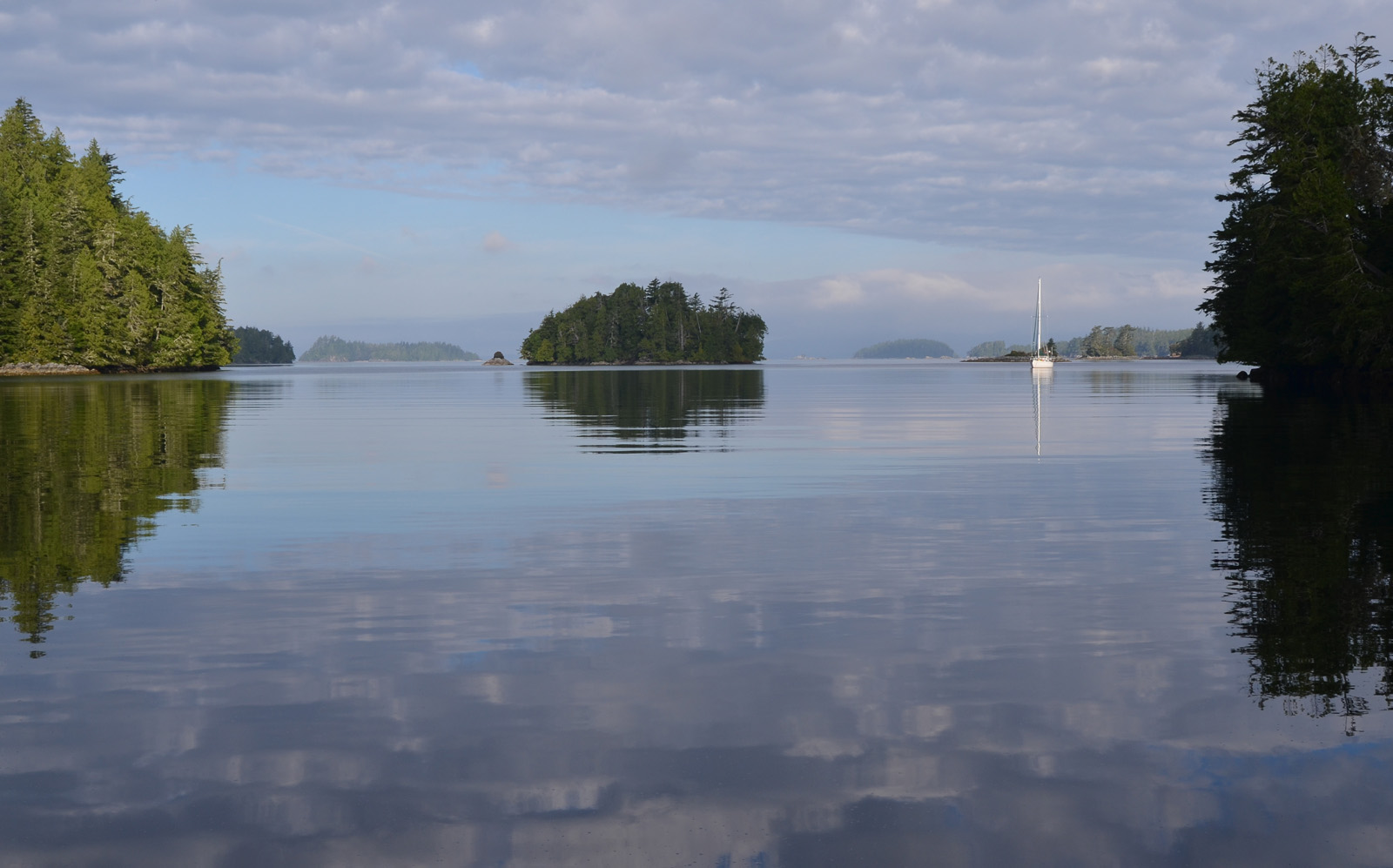
Sail Rock
We enjoyed seeing some of the sights we had missed on our sodden return trip to Ucluelet as we wove through the rocks and reefs guarding the island group. These were the outermost of the barriers that kept the worst of the swells out of the island anchorages, and as such they were barren and windswept.

Effingham Bay has capacity for many boats, and the guides suggested that it would be crowded. It was empty, of course. We arrived there a few minutes before a larger powerboat, and took the prime spot in the southeast cove. It was quite deep, over 40 feet, and not very wide, so we swung on less anchor rode than we would usually use. It didn't matter, no wind penetrated our hideaway during our stay. The currents in the cove did manage to twirl us around repeatedly, to the point that our anchor chain almost had knots in it when we brought it up, there was so much twist in it. Ever since we lost an anchor when a swivel failed, we had used just a moused shackle between the chain and the anchor, so there was no way for the twist to relax.

We mounted our first dinghy expedition around Effingham Island itself, since there were reported to be some interesting rock formations on the south side. There was a trail that started at the head of our cove which led across the island, but after seeing the wet and muddy condition of the first group to return, we opted to do the dinghy run around. We were glad we did, there were some sea stacks and sea caves that we never would have seen from the land route.


There were a couple of places that we were tempted to try to go into or through in the dinghy, but the thought of damaging the boat on the sharp rocks so far from help changed our minds. We satisfied ourselves with less involvement in the scenery.
As we came around the southeast corner of the island we could feel the swell coming in, and all along the south and west shore the waves crashed on the rocks. It was a little intimidating at first, with a 3-4 foot swell lifting our 8-foot dinghy, but we got used to the motion after a while and enjoyed the view as we rocked and rolled along the island.

Our second dinghy expedition took us further afield, to a small island closer to the open ocean. The offshore fog bank had moved in a little closer, so there was a lot of fog and mist here. Dicebox Island was at one point quite populated, with nine longhouses, but now it is empty and quite barren. It has several interesting caves, some of which you can access by foot or by dinghy.


The islands, islets, and random rocks of the Broken Group can be quite confusing, especially in fog, so I rigged up a dinghy mount for our portable chartplotter. We always have real paper charts on hand, just in case, but knowing exactly where you are in relation to the rocks is invaluable. If you get trapped in whiteout fog the paper isn't much use but the chartplotter could save your life.

Some of the islets are quite odd-looking, green growth contrasting with the bare rock, and trees growing in the smallest of cracks.
We called this one "Grumpy Old Man Rock". It reminded me of an elderly Popeye.


Circling Dicebox, we came upon a beach with good landing in sand and smooth rock, so we beached the dinghy and had a look around the island. We could not get to the most interesting cave on foot, but we finally found a trail to the other side of the island, which looked suspiciously unused, but it was five minutes of easy climbing to the beach on the far side.


"Beach" is a kind word for the jumble of rocks that we found, but even in this forbidding place we found beauty. Flowers will somehow grow even in the most unlikely of tiny spaces.


 As barren as the land is, the sea is full of exuberant life. In the tide pools, tiny hermit crabs, wearing the castoff shells of dead snails, and miniature sculpins went about their business, ignoring the looming humans staring at them. Starfish, some of them very odd-looking, were hanging on every surface. The rocks exposed to the pounding surf were thick with huge mussels, and only the lack of a fishing license prevented us from filling the dinghy with them. Next time, we get a license. Free food, especially of this quality, is not to be passed up.

We spent two days at Effingham Bay, enjoying the warm sun and calm seas, watching boats come and go. We were joined in the bay by several boats, which was very strange after being alone so much, but there was only room for one boat in our cove so everyone anchored well away from us.

The weather was holding, mainly sunny and calm, so we thought we would try one of the "conditional" anchorages in the outer islands. Wouwer Island had come highly recommended by several cruisers we had met in Ucluelet, so we reluctantly weighed anchor and motored out of Effingham.

Anne on cleanup detail.
The holding tank was full, so we motored out to mid-channel to pump it out. Anne went below to throw the switch, and came up shortly saying the pump had stopped suddenly after a brief grunting. I went below to check, and indeed the pump threw the breaker every time I turned it on. The macerator pump, which had been sounding increasingly distressed lately, had finally expired.

This wasn't a total calamity, since I had a spare pump on board, but there was no way I was looking forward to the impending pump dismounting and reinstallation. We anchored off Wouwer Island and got to work. I had planned well, I had a piece of plastic sheeting big enough to line the hull area under the pump, there was a shutoff valve on the tank before the pump, and I had a strong stomach. I needed it. Hanging head-down under the V-berth is bad enough, but throw in a quantity of well-aged sewage and it's something out of Dante. Anne was a trooper and helped in the disposal of said sewage overboard.

Never leave home without heavy rubber gloves
The old pump had been glued into the bronze valve body, and there was no way it was coming loose easily. I didn't want to stress it too much since the whole affair was supported only by the plastic fitting welded into the tank. I didn't have a pipe wrench, so I drilled a large hole through the pump body and tried twisting it off with a large screwdriver inserted in the hole. That was fruitless, so I hacksawed the pump off as close to the fitting as I could then made several hacksaw cuts on the inside of the remaining chunks of pump so I could break them loose. It was delicate work since I didn't want to damage the threads on the bronze fitting in the process. Two hours after starting the process, I had the new pump in place and wired up.

By this time it was getting late, so we set out a stern line to shore to stop us from swinging into the rocks and reef fringing our little sanctuary and settled in. It was surprisingly calm there even though we were right on the fringe of the ocean. No swells came in and after a good cleanup and dinner we slept the good sleep of exhaustion.


The next morning the sun shone and we loaded up the dinghy for more exploration. The rocks here, exposed to the pounding ocean, are smooth, and the trees and bushes cling to them in desperation. The wind has sculpted them into streamlined shapes that won't be torn off in winter storms.

Who knows how these trees and bushes survive for many years on barren rock with no visible soil or fresh water. Looking at the way they have grown, crouched low to the rock, leaves you with a feeling of amazement. Life is pretty durable.

Life is also pretty weird sometimes. We don't know what these perfect balls of vegetation are, but they grow all over the dead trees in this area. Seen through binoculars, they look like something from a deranged florist.

We had spoken to some kayakers who told us that there were sea lions on the rocks just around the corner from our anchorage, so we went for a look. True enough, even though we had been close to these rocks earlier and we hadn't seen any, on our return we saw several. Huge beasts, and smelly. They were apparently quite used to humans since they didn't move away from the group of kayakers who were there already, and ignored the motor noise from our dinghy also.

We stayed out there for quite a while, bobbing in the swell and backwash from breaking waves on the other side of the rocks. There were seals on the rocks too so we got a good dose of nature in the raw.


Barkley Sound from Dodger Passage
The weather forecast was looking good for another day or two but there was another front on the way, with gale warnings for our area, so we reluctantly took in our stern line, upped anchor, and motored out of the Broken Group towards our next destination. On the way, we deep-sixed the old macerator pump; there was no way we were going to carry that around with us. .
We had decided against Bamfield since it was going to add another hour to our trip and it was long enough already, so we were going to Dodger Passage, closer to the entrance of Barkley Sound. On the way across Imperial Eagle Channel the warning light came on and we shut the motor down. The new alternator belt had exploded. It appeared the belt dressing I had used on it had softened the rubber to the point that it shredded. The bottom of the engine compartment was covered in black rubber dust and bits of belt were all over. I was getting low on spares, I only had three belts left. It was the usual fun of working on a hot motor while pitching up and down in four-foot swells, but I was getting good at this by now and it only took ten minutes. We finally put the hook down in Dodger Channel and after a well-deserved happy hour, we had a late dinner went to bed with the alarm set for five AM. With close to 80 miles to go the next day, we needed all the time we could get.

Thursday, 29 August 2013

The Broken Group Part 1

It was Saturday, August 24, and we were headed to the largest anchorage in the Broken Group, known as Joe's Bay, with the aim of doing some local exploring in the dinghy. The first thing I noticed about the islands in the area is that they all leaned backwards, even the ones further in. The trees grow away from the force of the usual wind so all the islands look like they are accelerating out to the open ocean. As we left the Pinkerton Islands the fog was lifting and it got lighter as we went further. We were ready for some time without rain, the Pinkertons had been generally torrential and we hadn't even got off the boat in the dinghy.
The other thing I noticed is how close together all these little islands, islets, and reefs actually are. Barkley Sound is only 13 miles across, and the Broken Group occupies only half of it, so we generally spent more time getting organized, unanchoring, reanchoring and getting ourselves sorted out than we spent actually getting anywhere. 

We didn't have to wait long for the fog to lift, by the time we had settled at anchor the sky was blue and the sun shone again. The bay is home to two of the largest kayak camps in Barkley Sound, so there is a constant flow of kayaks coming and going. Many use the island as a base and do day-trips to the surrounding islands, returning to their camps each night.

At low tide you could see the reef that cuts the bay in half, leaving a small cut in the middle for transit. We went around a few of the local islands in the dinghy, being very careful because the swell from the open ocean penetrates quite far into the sound. The islands reminded us a lot of the Gulf Islands, mostly low and small, but there was a lot more wildness to these ones.


"Red sky at night, sailor delight, red sky at morn, sailor be warned". I don't shoot a lot of sunrises, I'm lazy for starters and the sunrises on the west coast are generally shrouded in fog. However, this one was definitely red, so we paid attention. We had stayed in that corner of the bay for a couple of days, enjoying the good weather, but the weather forecast was turning sour, and there was a major blow predicted for the coast, winds southeast to 45 knots in our area, 55 knots further north. We thought that the other side of the bay would be more protected and the predicted wind put us on a lee shore where we were currently, so we upped anchor on the 25th and moved to the southeast corner, where we would be protected by the tall trees.

For a while, it seemed that everything was working according to plan. The rain overnight was plentiful and hard, and the wind whistled through the rigging. As the wind built, however, it started curling around the southeast corner in vigorous blasts, driving us further back on the anchor and swinging us closer to shore.
I was maintaining anchor watch using our GPS, and when the swing suddenly moved back substantially, I decided that I didn't want to risk dragging onto the pile of rocks that was looming closer, so we moved to the middle of the bay and reanchored.

I was trying to lash the kayak down on the foredeck when the wind suddenly caught it and it was held in the air horizontally beside the boat, with me hanging on grimly. I finally managed to get it down into the water and it rode happily next to the dinghy behind the boat, both getting ever fuller with rainwater. It was much windier out there but I could put out a lot more anchor line and felt much more secure knowing I could drag for hundreds of feet without hitting anything. As it turned out, this anchor set did not move an inch and we rode the storm out without further mishap. We felt much luckier than the kayakers; one little boy riding in the front seat of a double, with his oilskin-clad father paddling, said "Wouldn't you like a boat that size, Dad?" Dad, tired, dirty, bearded and dripping wet, gazed wistfully up at our boat, and answered "that sure would be nice". It sure was.

We had spent more time in Joe's Bay than we had intended due to getting storm-ready, the holding tank was full and we had to get out to deep water to pump it out, and we were getting tired of looking at the same landscape, so on Tuesday Aug. 27 we took advantage of a relatively rain-free break and set out for Jaques-Jarvis Lagoon. Although it was only three miles away we managed to double that by exploring some of the surrounding islands on the way. Jaques-Jarvis Lagoon is noted for its difficult entrance, so of course we had to go there. The guide books stated we should go in an hour before high tide with the sun behind us. We were there three hours before high tide with fog and a ripple on the water. With a charted depth of three feet at low tide, squeezed in by a reef from one side and a rock on the other, the entry was taken very slowly and carefully, with a bow lookout. We managed a good line in with a minimum depth of 10 feet under our 6'6" draft keel and a couple of feet to spare on each side.

One of the writers commenting on the lagoon uses the word "primeval", and it certainly was. There was total silence but for the gurgle of a waterfall hidden in the trees, the water was glassy calm, and the foliage in the overcast light looked incredibly green, like someone had doubled the saturation. We took advantage of the momentary lack of rain to do a dinghy survey of our watery kingdom, since of course we were alone again. It was one of those places where you couldn't imagine putting a noisy engine on the dinghy; it was almost sacreligious to make noise from water dripping from the oars.

It had been a week since we left Ucluelet. We had emptied our reserve 5 gallons of water into the tanks, we had a couple of slices of bread and a couple of cups of milk left, so our time in the lagoon was unfortunately limited. Our night there was punctuated by bursts of heavy rain, but thankfully no strong wind could penetrate. The forecast was for more rain and wind, so a dry period on Wednesday morning gave us enough of a window to get organized to move. Getting out of the lagoon was made even trickier than the entry because we were nowhere near high tide. With less than seven feet of water, we followed our incoming line exactly and had no problems, but we were moving as slowly as I could manage. The underwater rocks were clearly visible on my side, just feet away. We made a resolution to come back here, we need to see this place again, preferably in sunlight.
Our run back to Ucluelet yesterday was very wet and foggy, but we had phoned ahead (cell phone coverage at last!) and Kevin and his staff were waiting on the dock for us. We got exactly the same space we had left a week earlier, so we tied up and set about drying out. We had foulie jackets and pants hanging all over the boat, we had damp charts taped up in the salon, and we had a lot of just plain wet everywhere. Lunch at the Floathouse Restaurant was a wonderful thing, as were the hot showers later. We went shopping at the Co-op and marveled at all the things on the shelves, but we were focused. Anne came up with a great idea: we took Ziploc freezer bags with us, bought our meats for the next week, divided them up and put them in the freezer bags on the spot, and handed them over to the butcher, who was happy to freeze them for us overnight.
It's Thursday, it's howling wind and pouring rain out there, and we are staying another night on the dock in good ol' Ucluelet. We picked up our frozen meats and a bunch of other supplies but tonight we're going to get all dressed up and go out for dinner. Unfortunately, dressing up in foul-weather gear and staggering down the slick dock to the Floathouse is going to be as good as it gets.

We won't be dining outside this time...stylin' in Ukee


Wednesday, 28 August 2013

Barkley Sound


It started out well enough. Magnus and Ronel had bid adieu on their way to Turtle Island and parts south, and cast off early. We had a few things to finish off, so we left a few hours later. We had a good run up the northwest side of Barkley sound, again motorsailing with the wind dead aft, heading for the fabled Lucky Creek. Of course, they were there already. We checked out the anchoring options and decided to share their space behind Refuge Island.


It was a pretty spot, and well sheltered. They had trouble setting their anchor in the shallower water due to a lot of rock, so had anchored in about 55 feet, but we got a good bite at 30 feet and settled in. We were sitting down for our sundowner when we saw them going for a run in their dinghy, then slow down and eventually stop, rowing quietly.

They had a black bear on the beach. We were a long way away, but we tracked them with camera and binoculars. The bear wandered the beach for a long time before disappearing into the brush, and Magnus and Ronel finally started the motor and came back to the anchorage. They were gobsmacked, they were so close for so long. (Ironically, the next morning a large tourist boat came around looking for the bear. We felt like specimens ourselves in our sailboats as the tourists, many German, waved and smiled as they went past). After congratulating them on their bear-sighting coup, we arranged to share their dinghy on the run up Lucky Creek the next day since it was much faster than our rubber ducky.


In a way, it was a bad choice of destinations at that time, since we had just showered the day before and didn't really need to bathe again so soon, but we really had no idea what we were in for when we made the trip up Lucky Creek the next day. It is only accessible close to high tide because the creek essentially dries at low water, so we had a few shallower spots to avoid with three hours to go before high.It is very interesting boating up small creeks and rivers, you never know what you may find.


As we approached the falls, we saw that there were a couple of people there ahead of us, and they were not wearing anything that could be called clothing. They dressed before we got there, which was fortunate, not that I'm being judgemental at all. We saw that they had left their dinghy at the bottom of the cliff, and did the same, crawling up like a bunch of alpinists. To get to the upper pools we had to strip down to swimsuits and stroke through the cold water to the next spot. It was at this point that Anne discovered the trail to the easy landing below the falls that didn't require swimming.

The water was what Magnus would describe as "refreshing" and what I would describe as "freezing". We all got totally wet, but some were happier with it than others. I liked the parts where we sat on the rocks in the sun with our feet in the water.


Ronel was almost as suspicious of cold water as I was, but was a little braver. She waded in, I had to dive. She swam to the rock shelf and climbed up gracefully, I came up like a chimpanzee dropped into the Arctic Ocean, gibbering and clutching for a foothold on the slippery rocks. For the last four feet I was skittering above the surface like a giant waterbug.


We whiled away the afternoon there, enjoying the sunshine and clean water. It has been described like a Disneyesque creation, a perfect little waterfall. It's true.

Magnus and Ronel climbed back down the cliff to the dinghy, then came and picked us up at the base of the "easy" way in. I thought it was easier, it had a larger knotted rope than the one going up the rock face, but Anne wasn't convinced. I liked it because I couldn't see anything hard at the bottom to land on.


The next morning, they set sail for the Outer Islands in the Broken Group, and we refused to tell them where we were going. Just in case.


(Just kidding. It never hurts to have a doctor in the next boat, even if he wants nothing to do with head injuries incurred while climbing. I wasn't ready to injure myself in his specialty, so we were at a stalemate). 


 We were actually going to the Pinkertons, a small archipelago of islands and reefs just north of the Broken Group, which is a national park. The Pinkertons are private, so there are things like fish farms in some of the best coves, and homes lining the shore in some places. Despite the status of the area, the charting is not all it could be, and we require a lot of guidance in the form of guidebooks. The chart to the left is a prime example of "local knowledge". The red arrow shows a rock in the middle of the channel.


That little dot on the left side of the channel in the photograph is that rock that spans that entire channel on the chart. This appears in none of the guidebooks we have, but seems important, at least to me. Strangely enough, this chart is about as high a resolution as you get for anything on the west coast of the island. Most of it is considerably lower resolution, so we spend a lot of time going slowly and staring at the depth sounder, looking hopeful.


The Pinkertons were damp. No, actually, the Pinkertons were monsoon-like. Anne said there were fountains of rain coming down inside the boat beside the mast. I wouldn't know, I sleep best in a storm.

After a couple of days of staring at rain and fog, we decided to go somewhere else and look at some different rain and fog. Off to Joe's Bay!

Wednesday, 21 August 2013

Buddy Boats


We were definitely closer to civilization, we were seeing sailboats constantly now instead of one every day or so, and a couple passed us, headed in to Bacchante, on our way out of the area on Friday, August 17. One of them was familiar, we had shared Bottleneck Cove with them during the worst of the deluge. It looked a little different now without the Great Blue Heron perched on his anemometer vane. I was surprised that the vane had survived at all.


Since Losloper had followed us out of Bacchante Bay, we were curious to see where they would go next. Since losing track of Pacific Wanderer we hadn’t seen any boats with regularity, but now we would wave back at boats we recognized from previous anchorages or fuel docks. Sure enough, they followed us all the way to Ahousat.
 They went further, into the anchorage, while we stopped at the Ahousat General Store for much-needed water and supplies. I tasted the water to make sure it was decent, then filled the tanks. More on this later...
 The store had decent stock and the prices were fair. At least half the store was stacked floor to ceiling with boxes of marine parts: oil and gas filters, nuts and bolts, plus all sorts of faded and shopworn odds and ends. A remarkable number of the odds and ends were priced at $60.20 for some reason, despite being worth anywhere from half to twice that amount.

We had lunch with the Losloper crew, Magnus and Ronel, who had come to the dock to fill their solar shower. The restaurant owner had decided to open even though it was Saturday, so we were in luck. Right next to the store, they served excellent fish and chips and pie with ice cream. Fresh seafood has been difficult to find, strangely enough. Everybody just catches their own, and since I don’t fish, Anne has to depend on the generosity of strangers.

After lunch, we anchored next to Losloper at the head of Matilda Inlet, where Anne went exploring in the kayak, and where we spent a rainy night. On the morning of August 18, it looked good enough to move to Quait Bay, where we hoped to find a famed “floating garden” called Fireweed, structure made from found materials, painted magenta and green. The Losloper crew had the same idea, so we followed them out of Matilda Inlet, but not without first doing a tour of the bay. 

The Atleo Greeter


Shawn Atleo, Grand Chief of the Assembly of First Nations of Canada, has a house on a small island in Matilda Inlet, with a magnificent greeting figure.


The Indian village of Marktosis, quite large by village standards, occupies the bay across from Ahousat, and their greeter is even bigger. Everyone we met along this path had lived up to  this tradition. It was reassuring to find ourselves so welcomed everywhere we went.

The fog cleared away quite early on our trip, so we were in bright sunshine within an hour or so. As we came in sight of Quait Bay, however, the exhaust noise from the engine changed abruptly. Unfortunately, I knew that noise all too well, and shut the motor off before the overheat alarm sounded. No cooling water was coming out. I expected to see some weed in the intake water strainer, or even a fish. We had already had two separate incidents involving fish getting stuck in the water intake before this adventure. When I took off the front of the engine cover, I found a tattered belt from the raw water pump lying in the bilge. The water was fortunately flat calm, with zero wind. It was a perfect day for a mishap like this. I requested Losloper to maintain radio watch in case we had any issues, since there was a reef nearby, and they turned around and came back to stand by until we fixed the problem. I had to remove the alternator belt to put a replacement belt on the raw water pump, so I replaced that with a new one also. Twenty minutes after we turned the engine off, we were under way again, with Losloper following just in case.
Losloper at the entrance to Quait Bay


We of course anchored at opposite ends of the bay. In our case, we wanted to hide one of Quait Bay’s peculiarities, a floating luxury lodge, currently closed. The caretaker lives on her boat at the dock. The last report we saw prior to the closure was that the dinner menu started at $100, so we could understand a certain lack of business from the locals.


We spent part of the day looking for the floating garden, but neither of our two search teams found it. They found what was possibly the framework of something like that, but that was it. Things move and disappear out here, frequently without warning.


After another rainy night, we saw Losloper pulling up anchor early, in a light mist. They wanted to get to Ucluelet that day, and from Quait Bay it was a bit of a trek. We were just going to Tofino,  about ten miles, so we hung around for a couple of hours and waited for the boat to dry off a bit. By the time we got our anchor up the sun had broken through the clouds and it was well on its way to being a beautiful day. We got to Tofino at 12 noon and went to the fuel dock to top up our diesel and fill the propane tank. The motion was ridiculous. With no breakwater, the constant flow of float planes and whale-watching boats blasting by at full speed left the water in a roiling mess. With the noise, I couldn’t tell how much diesel we needed. Usually I listen for the change of tone as the diesel fills the tank and starts to fill the hose to the deck fill. I didn’t want to spill a lot of diesel into the water so I picked a safe number of liters and went with that. We ended up with 3/4 of a tank. I wanted to look through the marine store there, in particular I wanted a spare raw water pump belt, but we couldn’t stay on the fuel dock for the search. We decided to go to the Fourth Street Dock, the largest and probably the only one with room, then walk back.
Well, we called the wharfinger on VHF radio, we called them on the phone, and there was no answer. The area on the docks marked for recreational use was filled with fishboats and decaying sailboats missing masts and other important bits. After a futile fifteen minutes of trying to raise some response I made an executive decision, and we headed out to sea, bound for Ucluelet. With all the noise and motion we wouldn’t have been happy at those docks in any case. We had heard from other cruisers that Tofino wasn’t cruiser-friendly and our experience bore that out.
We passed Lennard Island on the way, dodging crab trap buoys all the way out. The water is shallow around here so we were in 40 to 60 feet for a long time. We thought the buoys would disappear as we got further out, but we were wrong. We dodged them all the way to Ucluelet.
We got the sails up and drawing as we passed Lennard, but soon ran out of wind and motorsailed with the main up to give us some stability. The seas were reported as three to six feet, with a two-foot chop on top of that. It was lumpy. With six knots of wind off the starboard quarter, the boat rolled like a drunken pig and the mainsail emptied and filled with a big bang on each roll. I was concerned that our main wasn’t going to last for another three hours of this, so we took it down and rolled out the genoa instead. It gave us some stability and added a bit to our speed, especially since the wind filled in from abeam about five minutes after the main came down. So we rolled and pitched down the coast, seeing what we could through binoculars. Because the water is so shallow and there are many rocks extending from the coast, we kept about three miles out in 100 feet of water. Long Beach is very long. One of the peculiarities of the whole west coast of the island is that because there are so many things to hit close to shore you have to stay well out so you really don’t see a lot of the coast close-up, especially in fog.

Amphitrite Light
As we closed in on Amphitrite Light, at the entrance to Barkley Sound, the seas got even lumpier and more random. The joys of shallow water with reefs strewn through it at random.
The instructions for entering Ucluelet Inlet involve starting at whistle buoy Y42 and heading directly for bell buoy Y43. “Whistle buoy” is a bit of misnomer, that buoy sounds like moans from Hell.

I thought I saw a bit of a spout off to starboard as we did the run to Y42, then suddenly a humpback whale surfaced right off the bow, traveling almost on a reciprocal course to ours. I grabbed my camera and held the shutter button down for continuous shooting as the whale surfaced twice more before diving. That was a huge kick.
SALTS ships in Ucluelet Inlet


Ucluelet Inlet is long and shallow, the buoyed path to the public docks snakes past Spring Cove and Port Albion before you get to Ucluelet proper. We had phoned ahead and they made room for us at the dock and two uniformed dockhands were there to help us in. That was good, we were in a spot just long enough for us, although with enough extra room to tie the dinghy sideways across the stern. Getting in involved heading straight for the middle of the space then turning hard right as the bow swept the dock, simultaneously putting the boat into reverse to suck the stern in. We got it first try, which was good since missing it would have involved backing off into a mud bank. The harbour has been dredged, but only for another 50 feet or so beyond our dock. This means that most of the outgoing and returning charter fishboat fleet goes right past our boat. The Canadian Princess boat drivers in particular, handling 40-foot powerboats, only have two speeds, on and off. One had to do a panic stop/start from ten knots right beside our boat when another large boat showed at the entrance; he missed crushing our starboard side by four inches and sent waves crashing into the side of our boat. That would have shortened our holiday on the spot.

Civilization, more or less.
After showering, we had pizza for lunch yesterday, the first pizza for months. It was excellent. We also got to do some shopping in the relatively huge Co-op store. Fresh lettuce! Apples, oranges, exotic fruit like nectarines that we hadn’t seen since we left Victoria. Unfrozen meat! They delivered our groceries, wine, and Anne to the dock for $3.50. I got to walk because there were only two seats in the van. I spent a lot of time pumping out the water we had loaded in Ahousat; it wasn't bad, it was just a weird yellow colour. After emptying the tanks, I half-filled them, then pumped out and rinsed the water heater. Two hours later, we had tanks full of water which didn't look like a lab sample.


Our refrigerator is full, which is good because it’s going to be a long time until we can get more. There aren’t any stores in the Broken Group in Barkley Sound, which is our next destination. Later today, after more shopping and topping up with diesel for real, we are off to Lucky Creek in Pipestem Inlet as a starting point, and we will see where destiny takes us after that. We have given ourselves enough time to enjoy what is reportedly the best part of the west coast. Our next report will probably come from Bamfield as we get ready for the final 80-mile sprint down Juan de Fuca Strait to Sooke.


This is something I have been working on for years: water totems. Early in the morning or late in the day the light is more sculptural and the water is flat and mirror-like. Every once in a while one of the images I capture works as nature's Rorschach. You can make up your own story about this one.